Soubor:Austria satellite Grosslandschaften markerstyle.png
Z Multimediaexpo.cz
Velikost tohoto náhledu je: 800 × 429 pixelů
Obrázek ve vyšším rozlišení (rozměr: 2 457 × 1 318 pixelů, velikost souboru: 6,11 MB, MIME typ: image/png)
Mapa + Description:
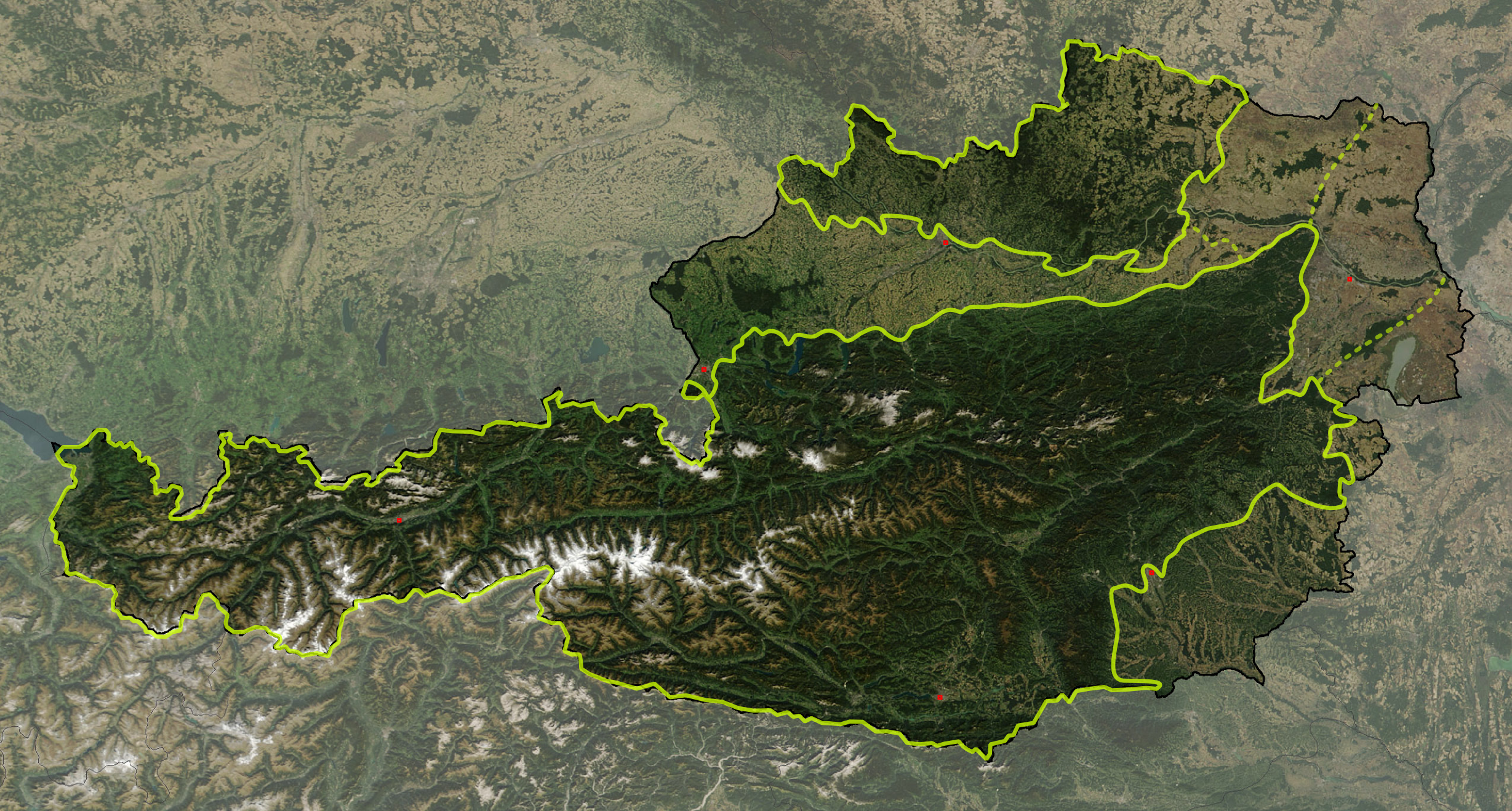
- Deutsch: Satellitenbild von Österreich, mit den Großlandschaften: Österreichische Alpen, Vorländer und randalpine Becken, Granit- und Gneishochland
- English: Satellite image of Austria with greater landscapes: Austrian Alps, Alpine Forelands and Rim Basins, Granite and Gneiss Highlands
- Date: 18 March 2008
- Source: The image is based on a satellite image from [1]. Original image: Credit Jeff Schmaltz, MODIS Rapid Response Team, NASA/GSFC. It was cropped and reduced in contrast around Austria by Michael Schmid.
- Author: W!B:
+ pochází z Wikimedia Commons, kde má status – This file is in the public domain in the United States because it was solely created by NASA.
NASA copyright policy states that "NASA material is not protected by copyright unless noted".
(Use of NASA logos, insignia and emblems is restricted per U.S. law 14 CFR 1221)
NASA copyright policy states that "NASA material is not protected by copyright unless noted".
(Use of NASA logos, insignia and emblems is restricted per U.S. law 14 CFR 1221)
Historie souboru
Kliknutím na datum a čas se zobrazí tehdejší verze souboru.
| Datum a čas | Náhled | Rozměry | Uživatel | Komentář | |
|---|---|---|---|---|---|
| současná | 24. 5. 2022, 19:12 | | 2 457×1 318 (6,11 MB) | Sysop (diskuse | příspěvky) | (Fotografie + ) |
- Editovat tento soubor v externím programu (Více informací najdete v nápovědě pro nastavení.)
Odkazy na soubor
Na soubor odkazuje tato stránka:


