Soubor:Colonization 1945.png
Z Multimediaexpo.cz
Velikost tohoto náhledu je: 800 × 355 pixelů
Obrázek ve vyšším rozlišení (rozměr: 1 438 × 638 pixelů, velikost souboru: 92 kB, MIME typ: image/png)
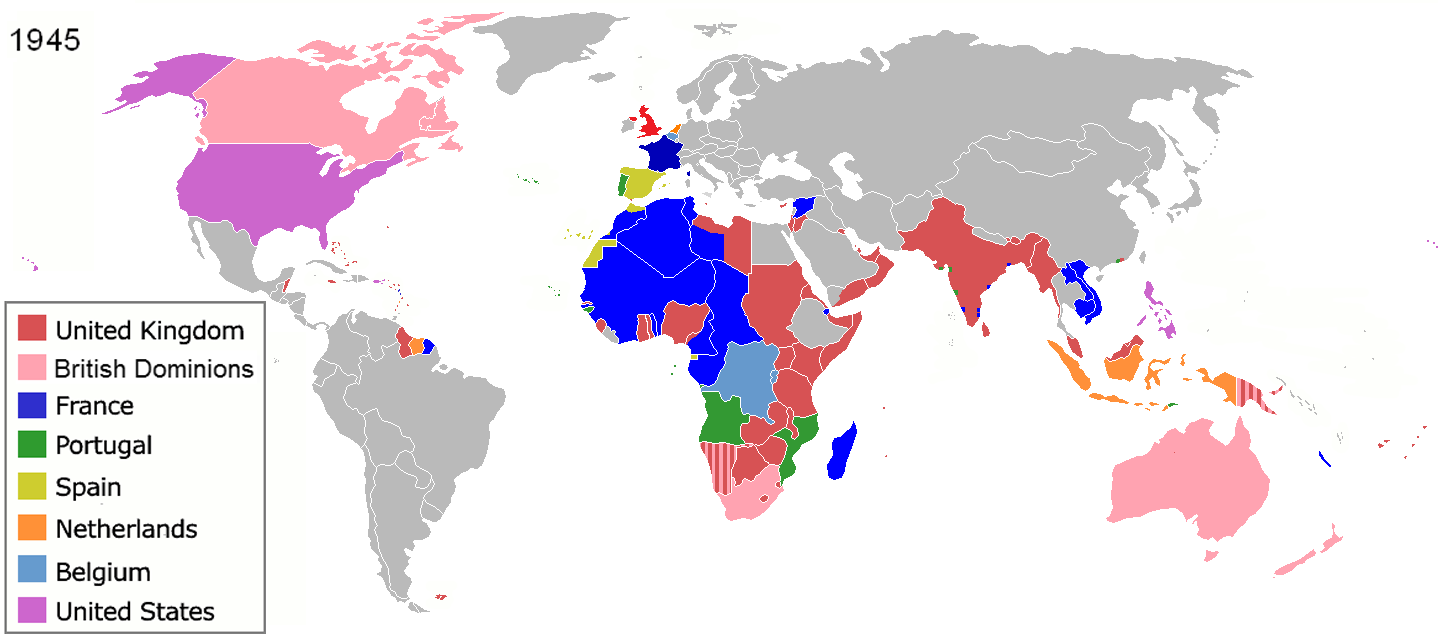
Mapa + English: The colors represent the colonies of various nations in 1945, and the colonial borders of that time.
- Français: Les couleurs représentent les colonies des diverses pays en 1945 et les frontières coloniales de l'époque.
- Español: Colonialismo en 1945
- Date: (unknown)
- Source: File:Colonisation2a.gif
- Author: en:User:Aris Katsaris
+ pochází z Wikimedia Commons, kde má status – Creative Commons Attribution-Share Alike 3.0 Unported license.
Historie souboru
Kliknutím na datum a čas se zobrazí tehdejší verze souboru.
| Datum a čas | Náhled | Rozměry | Uživatel | Komentář | |
|---|---|---|---|---|---|
| současná | 24. 7. 2017, 11:03 | | 1 438×638 (92 kB) | Sysop (diskuse | příspěvky) | (Mapa + English: The colors represent the colonies of various nations in 1945, and the colonial borders of that time. * Français: Les couleurs représentent les colonies des diverses pays en 1945 et les frontières coloniales de l'époque. * Español: Col) |
- Editovat tento soubor v externím programu (Více informací najdete v nápovědě pro nastavení.)
Odkazy na soubor
Na soubor odkazují tyto 2 stránky:


