Soubor:Coronado expedition.jpg
Z Multimediaexpo.cz
Velikost tohoto náhledu je: 800 × 346 pixelů
Obrázek ve vyšším rozlišení (rozměr: 1 230 × 532 pixelů, velikost souboru: 130 kB, MIME typ: image/jpeg)
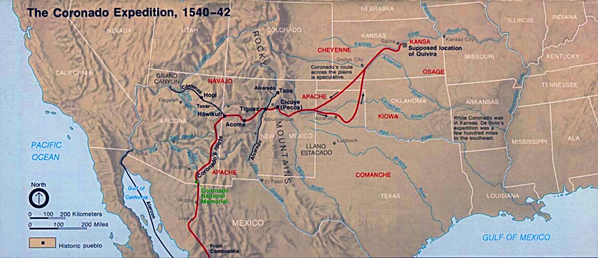
Mapa + English: Map of the Coronado Expedition route.
- Lead by Francisco Vásquez de Coronado, from 1540 through 1542.
- From México City in Colonial México, through Colonial New México (Provéncia de Santa Fe De Nuevo México), and into the Great Plains (in present day Kansas).
- Credits:
- From: www - lib.utexas.edu/Libs/PCL/Map_collection/histus.html archive copy
- "Courtesy of the University of Texas Libraries, The University of Texas at Austin."
+ pochází z Wikimedia Commons, kde má status – This image or media file contains material based on a work of a National Park Service employee, created as part of that person's official duties. As a work of the U.S. federal government, such work is in the public domain in the United States.
Historie souboru
Kliknutím na datum a čas se zobrazí tehdejší verze souboru.
| Datum a čas | Náhled | Rozměry | Uživatel | Komentář | |
|---|---|---|---|---|---|
| současná | 11. 8. 2014, 07:03 | | 1 230×532 (130 kB) | Sysop (diskuse | příspěvky) | (Fotografie+) |
- Editovat tento soubor v externím programu (Více informací najdete v nápovědě pro nastavení.)
Odkazy na soubor
Na soubor odkazuje tato stránka:


