Soubor:Deutsches Reich2.png
Z Multimediaexpo.cz
Velikost tohoto náhledu je: 660 × 599 pixelů
Obrázek ve vyšším rozlišení (rozměr: 2 362 × 2 145 pixelů, velikost souboru: 2,67 MB, MIME typ: image/png)
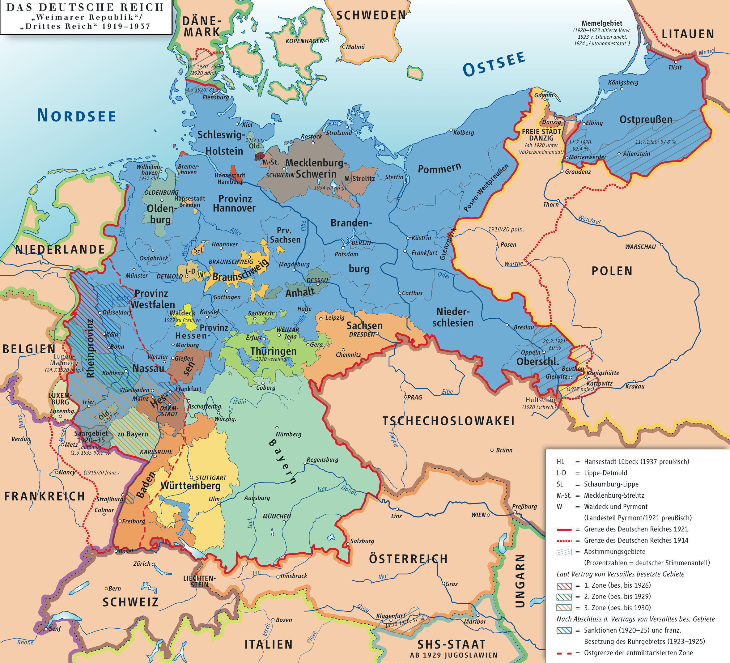
Mapa + Description: Karte des Deutschen Reiches, »Weimarer Republik« 1919–1937 / Map of German Empire, »Republic of Weimar« 1919–1937
- Date: 6 October 2006
- Source: own drawing/Source of Information: Putzger – Historischer Weltatlas, 89. Auflage, 1965
- Author: kgberger
+ pochází z Wikimedia Commons, kde má status – Permission is granted to copy, distribute and/or modify this document under the terms of the GNU Free Documentation License, Version 1.2 or any later version published by the Free Software Foundation; with no Invariant Sections, no Front-Cover Texts, and no Back-Cover Texts.
Historie souboru
Kliknutím na datum a čas se zobrazí tehdejší verze souboru.
| Datum a čas | Náhled | Rozměry | Uživatel | Komentář | |
|---|---|---|---|---|---|
| současná | 21. 5. 2013, 17:30 | | 2 362×2 145 (2,67 MB) | Sysop (diskuse | příspěvky) | (FILE1122) |
- Editovat tento soubor v externím programu (Více informací najdete v nápovědě pro nastavení.)
Odkazy na soubor
Na soubor odkazují tyto 2 stránky:


