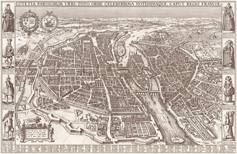
Soubor:Map of Paris by Claes Jansz. Visscher - Harold B. Lee Library.jpg
Z Multimediaexpo.cz

Velikost tohoto náhledu je: 800 × 520 pixelů
Obrázek ve vyšším rozlišení (rozměr: 20 207 × 13 139 pixelů, velikost souboru: 43,36 MB, MIME typ: image/jpeg)
GIGANTICKÁ Mapa + Title: Lutetia Parisorum urbs, toto orbe celeberrima notissimaque, caput regni Franciae.
- Description: Map of the city of Paris. Scale: ca. 1:2.000.
- Date: 1618
- Dimensions: Height: 55 cm (21.7 in). Width: 85 cm (33.5 in).
- Author: Claes Jansz. Visscher (1586–1652)
- Current location: Harold B. Lee Library
+ pochází z Wikimedia Commons, kde má status – This work is in the public domain in the United States, and those countries with a copyright term of life of the author plus 100 years or less.
Historie souboru
Kliknutím na datum a čas se zobrazí tehdejší verze souboru.
| Datum a čas | Náhled | Rozměry | Uživatel | Komentář | |
|---|---|---|---|---|---|
| současná | 29. 1. 2015, 12:53 |  | 20 207×13 139 (43,36 MB) | Sysop (diskuse | příspěvky) | (GIGAFotografie+100) |
- Editovat tento soubor v externím programu (Více informací najdete v nápovědě pro nastavení.)
Odkazy na soubor
Na tento soubor neodkazuje žádná stránka.
