Soubor:Map of Russian subjects by type, 2008-03-01.png
Z Multimediaexpo.cz
Velikost tohoto náhledu je: 800 × 462 pixelů
Obrázek ve vyšším rozlišení (rozměr: 1 000 × 577 pixelů, velikost souboru: 150 kB, MIME typ: image/png)
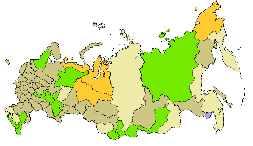
Mapa + Description:
- Map of Russia with merged subjects (01.03.2008, last merger Chita Oblast+Agin-Buryat Autonomous Okrug to form Zabaykalsky Krai.)
- Colour tagged by type.
- ███ Republics
- ███ Krais (territories)
- ███ Oblasts (provinces)
- ███ Federal cities
- ███ Autonomous oblasts (provinces)
- ███ Autonomous okrugs (districts)
- There is also a layer for the different Federal districts (seen as thicker line on map)
- Date: 27 January 2008
- Author: Lokal_Profil
+ pochází z Wikimedia Commons, kde má status – This file is licensed under the Creative Commons Attribution-Share Alike 2.5 Generic license. (CC BY-SA 2.5)
Historie souboru
Kliknutím na datum a čas se zobrazí tehdejší verze souboru.
| Datum a čas | Náhled | Rozměry | Uživatel | Komentář | |
|---|---|---|---|---|---|
| současná | 30. 3. 2014, 18:18 | | 1 000×577 (150 kB) | Sysop (diskuse | příspěvky) | (MW1.15-Fotografie) |
- Editovat tento soubor v externím programu (Více informací najdete v nápovědě pro nastavení.)
Odkazy na soubor
Na soubor odkazují tyto 2 stránky:


