Soubor:Mouths of amazon geocover 1990.png
Z Multimediaexpo.cz
Velikost tohoto náhledu je: 800 × 527 pixelů
Obrázek ve vyšším rozlišení (rozměr: 992 × 653 pixelů, velikost souboru: 1,4 MB, MIME typ: image/png)
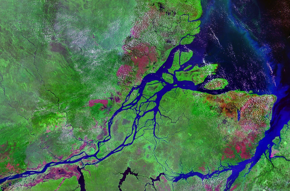
Fotografie + English: Satellite image of mouths of Amazon River in Brazil, with Marajó Island in the center, and the cities (in red) of Macapá (left) and Belém (right).
- Author: Roke~commonswiki
+ pochází z Wikimedia Commons, kde má status – This image is in the public domain because it is a screenshot from NASA’s globe software World Wind using a public domain layer, such as Blue Marble, MODIS, Landsat, SRTM, USGS or GLOBE.
Historie souboru
Kliknutím na datum a čas se zobrazí tehdejší verze souboru.
| Datum a čas | Náhled | Rozměry | Uživatel | Komentář | |
|---|---|---|---|---|---|
| současná | 4. 4. 2014, 22:38 | | 992×653 (1,4 MB) | Sysop (diskuse | příspěvky) | (MW1.15-Fotografie) |
- Editovat tento soubor v externím programu (Více informací najdete v nápovědě pro nastavení.)


