Soubor:Sunda strait map v3.png
Z Multimediaexpo.cz
Větší rozlišení není k dispozici.
Sunda_strait_map_v3.png (rozměr: 489 × 600 pixelů, velikost souboru: 310 kB, MIME typ: image/png)
Mapa + Description:
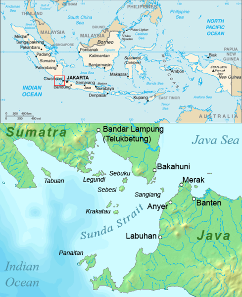
- English: Map of the Sunda Strait, Indonesia.
- Date: 26 August 2006
- Source: Combination of CIA World Factbook map and Demis Map Server (http://www2.demis.nl/mapserver/mapper.asp) data with additional annotations and modifications by self.
- Author: ChrisO
+ pochází z Wikimedia Commons, kde má status – This image is a work of a Central Intelligence Agency employee, taken or made as part of that person's official duties. As a Work of the United States Government, this image or media is in the public domain in the United States.
Historie souboru
Kliknutím na datum a čas se zobrazí tehdejší verze souboru.
| Datum a čas | Náhled | Rozměry | Uživatel | Komentář | |
|---|---|---|---|---|---|
| současná | 10. 11. 2014, 07:42 | | 489×600 (310 kB) | Sysop (diskuse | příspěvky) | (Fotografie+90) |
- Editovat tento soubor v externím programu (Více informací najdete v nápovědě pro nastavení.)
Odkazy na soubor
Na soubor odkazuje tato stránka:


