V pátek 26. dubna 2024 úderem 22 hodiny začíná naše nová
a opravdu velká série soutěží o nejlepší webovou stránku !!
Proto neváhejte a začněte hned zítra soutěžit o lákavé ceny !!
a opravdu velká série soutěží o nejlepší webovou stránku !!
Proto neváhejte a začněte hned zítra soutěžit o lákavé ceny !!
Soubor:1759 map Holy Land and 12 Tribes.jpg
Z Multimediaexpo.cz
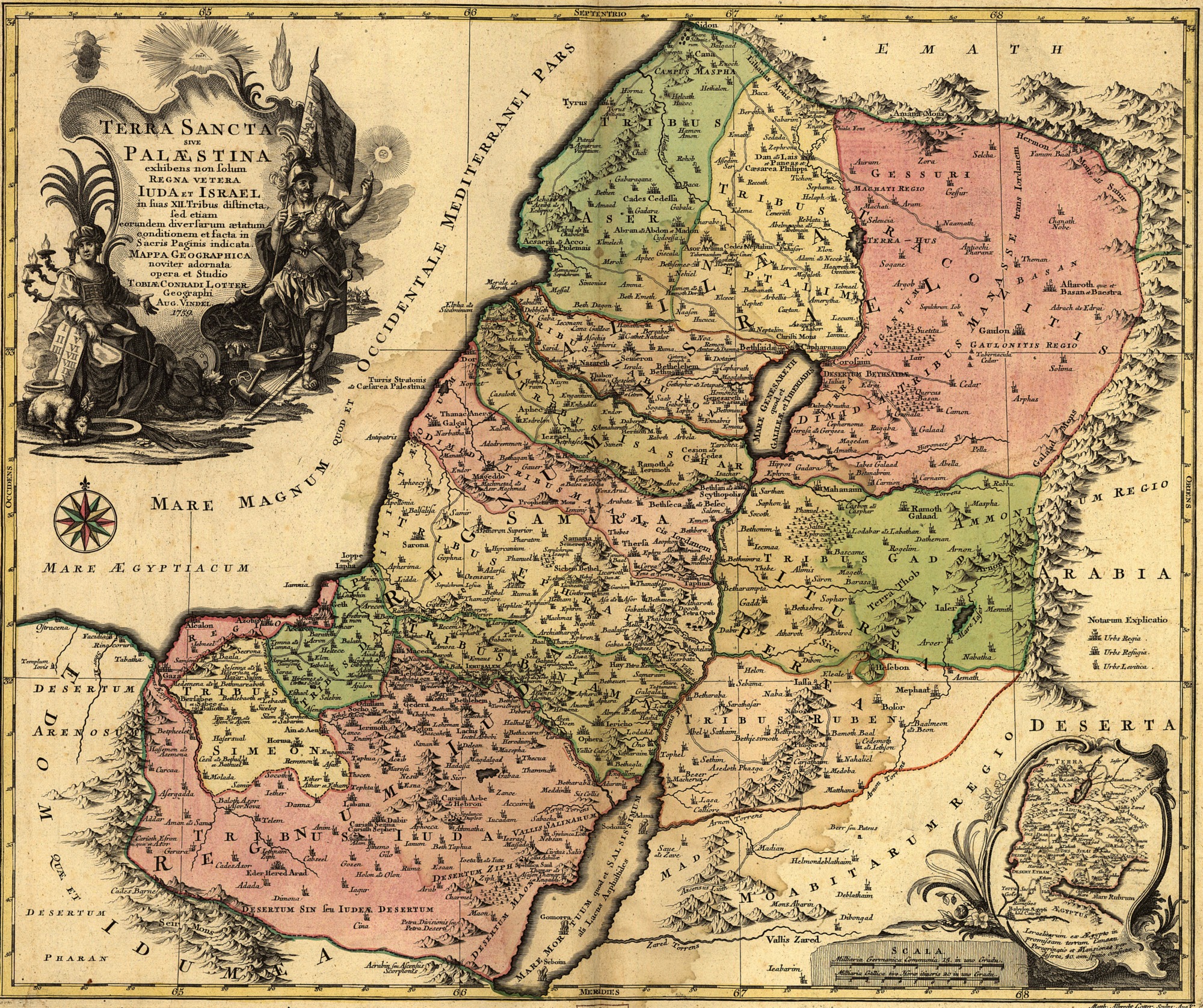
Velikost tohoto náhledu je: 715 × 599 pixelů
Obrázek ve vyšším rozlišení (rozměr: 2 000 × 1 676 pixelů, velikost souboru: 1,74 MB, MIME typ: image/jpeg)
Fotografie + Title: Latina: Terra Sancta sive Palæstina exhibens no ſolum Regna vetera Iuda et Israel in ſuas XII Tribus diſtincta, ſed etiam eorundem diverſarum ætatum conditionem et facta in Sacris Paginis idicata.
- Description: English: The Holy Land or Israel showing not only the Old Kingdoms of Judea and Israel but also the 12 Tribes Distinctly, Confirming their Locations Diversely in their Ancient Condition and Doing So as the Holy Scriptures Indicate.
- Date: 1759
- Medium: hand-colored
- Dimensions: 47 × 57 cm (18.5 × 22.4 in)
- Current location: Library of Congress Geography and Map Division Washington, D.C. 20540-4650
- Artist: Tobias Lotter (1717–1777)
+ pochází z Wikimedia Commons, kde má status – This work is in the public domain in its country of origin and other countries and areas where the copyright term is the author's life plus 100 years or less.
Historie souboru
Kliknutím na datum a čas se zobrazí tehdejší verze souboru.
| Datum a čas | Náhled | Rozměry | Uživatel | Komentář | |
|---|---|---|---|---|---|
| současná | 12. 1. 2016, 10:33 | | 2 000×1 676 (1,74 MB) | Student85 (diskuse | příspěvky) | (Fotografie+62) |
- Editovat tento soubor v externím programu (Více informací najdete v nápovědě pro nastavení.)
Odkazy na soubor
Na soubor odkazuje tato stránka:


