V pátek 26. dubna 2024 úderem 22 hodiny začíná naše nová
a opravdu velká série soutěží o nejlepší webovou stránku !!
Proto neváhejte a začněte hned zítra soutěžit o lákavé ceny !!
a opravdu velká série soutěží o nejlepší webovou stránku !!
Proto neváhejte a začněte hned zítra soutěžit o lákavé ceny !!
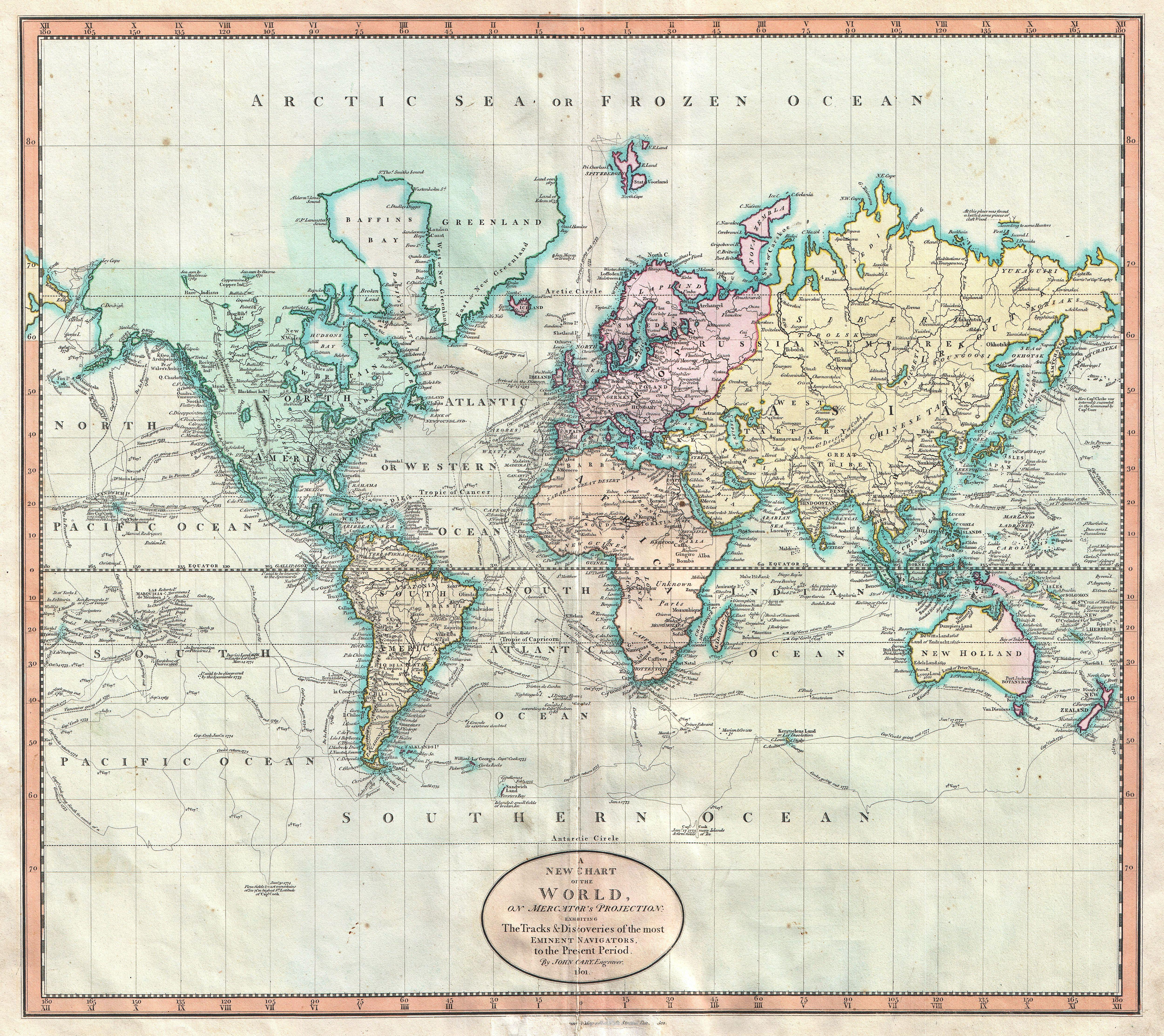
Soubor:1801 Cary Map of the World on Mercator Projection - Geographicus - WorldMerc-cary-1801.jpg
Z Multimediaexpo.cz
Velikost tohoto náhledu je: 674 × 600 pixelů
Obrázek ve vyšším rozlišení (rozměr: 5 000 × 4 451 pixelů, velikost souboru: 7,15 MB, MIME typ: image/jpeg)
Globální mapa + Title: A New Chart of the World, on Mercator's Projection: Exhibiting the Track & Discoveries of themost Eminent Navigators, to the Present Period.
- English: John Cary’s wonderful 1801 Map of the World on Mercator’s Projection. Details the entire world as it was known at the turn of the 19th century. Displays the continents in considerable detail but offers only minimal information in the Arctic and Antarctic latitudes. Designed to illustrate the explorations of the previous century, focusing specifically on the important explorations of Cook, Vancouver, Perouse, and Gores. Offers copious notations on explorations and unconfirmed discoveries throughout. Prepared in 1801 by John Cary for issue in his magnificent 1808 New Universal Atlas.
- Date: 1801 (dated)
- Dimensions – Height: 18.25 in (46.4 cm). Width: 20.25 in (51.4 cm).
- Artist: John Cary (1754–1835)
+ pochází z Wikimedia Commons, kde má status – This work is in the public domain in the United States, and those countries with a copyright term of life of the author plus 100 years or less.
Historie souboru
Kliknutím na datum a čas se zobrazí tehdejší verze souboru.
| Datum a čas | Náhled | Rozměry | Uživatel | Komentář | |
|---|---|---|---|---|---|
| současná | 29. 4. 2014, 21:06 | | 5 000×4 451 (7,15 MB) | Sysop (diskuse | příspěvky) | (Globální mapa + + pochází z Wikimedia Commons, kde má status – Kategorie:PD fotografie Kategorie:Maps showing history Kategorie:Mapy světa JPG ) |
- Editovat tento soubor v externím programu (Více informací najdete v nápovědě pro nastavení.)
Odkazy na soubor
Na tento soubor neodkazuje žádná stránka.


