V pátek 26. dubna 2024 úderem 22 hodiny začíná naše nová
a opravdu velká série soutěží o nejlepší webovou stránku !!
Proto neváhejte a začněte hned zítra soutěžit o lákavé ceny !!
a opravdu velká série soutěží o nejlepší webovou stránku !!
Proto neváhejte a začněte hned zítra soutěžit o lákavé ceny !!
Soubor:1920s Leconte Map of Paris w-Monuments and Map of Versailles - Geographicus - ParisVersailles-leconte-1920s - 2.jpg
Z Multimediaexpo.cz
Velikost tohoto náhledu je: 445 × 600 pixelů
Obrázek ve vyšším rozlišení (rozměr: 2 861 × 3 855 pixelů, velikost souboru: 6,58 MB, MIME typ: image/jpeg)
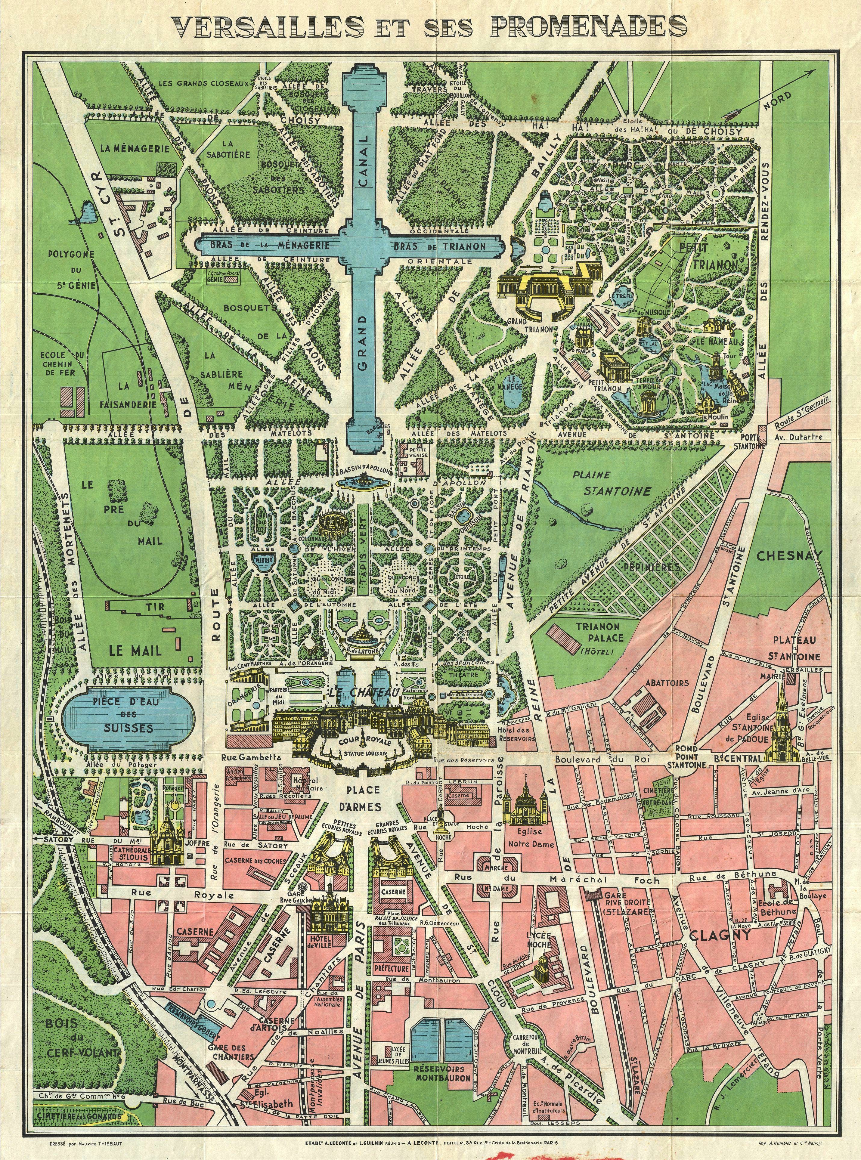
Mapa + Title: Versailles et ses Promenades
- Description:
- English: A tourist map with a general plan of Versailles and bird's-eye views of several notable features, including buildings, fountains, and statues. A similar map of Paris, titled Paris et ses Monuments, is printed on the other side.
- Date: circa 1925
- Dimensions: Height: 20 in (50.8 cm); Width: 26 in (66 cm)
- Inscriptions:
- bottom left: DRESSÉ par Maurice THIÉBAUT
- bottom center: ETABL.TS A. LECONTE et L. GUILMAN RÉUNIS – A LECONTE, EDITEUR, 38, Rue Ste. Croix de la Bretonnerie, PARIS
- bottom right: Imp. A. Humblot et Cie. Nancy
- Notes: http://www.geographicus.com/mm5/cartographers/leconte.txt
- Photographer: Geographicus link: ParisVersailles-leconte-1920s
- Artist: Maurice Thiébaut
+ pochází z Wikimedia Commons, kde má status – This work is in the public domain in its country of origin and other countries and areas where the copyright term is the author's life plus 70 years or less.
Historie souboru
Kliknutím na datum a čas se zobrazí tehdejší verze souboru.
| Datum a čas | Náhled | Rozměry | Uživatel | Komentář | |
|---|---|---|---|---|---|
| současná | 2. 12. 2020, 09:00 | | 2 861×3 855 (6,58 MB) | Sysop (diskuse | příspěvky) | (Fotografie + ) |
- Editovat tento soubor v externím programu (Více informací najdete v nápovědě pro nastavení.)
Odkazy na soubor
Na soubor odkazuje tato stránka:


