The final launch of the Allmultimedia.org will take place on February 24, 2026
(shortly after the 2026 Winter Olympics).
Dovolená : 23. prosinec 2025 — 29. prosinec 2025
Holidays : December 23, 2025 — December 29, 2025
Soubor:Aster newyorkcity lrg.jpg
Z Multimediaexpo.cz
Velikost tohoto náhledu je: 452 × 600 pixelů
Obrázek ve vyšším rozlišení (rozměr: 1 964 × 2 607 pixelů, velikost souboru: 3,31 MB, MIME typ: image/jpeg)
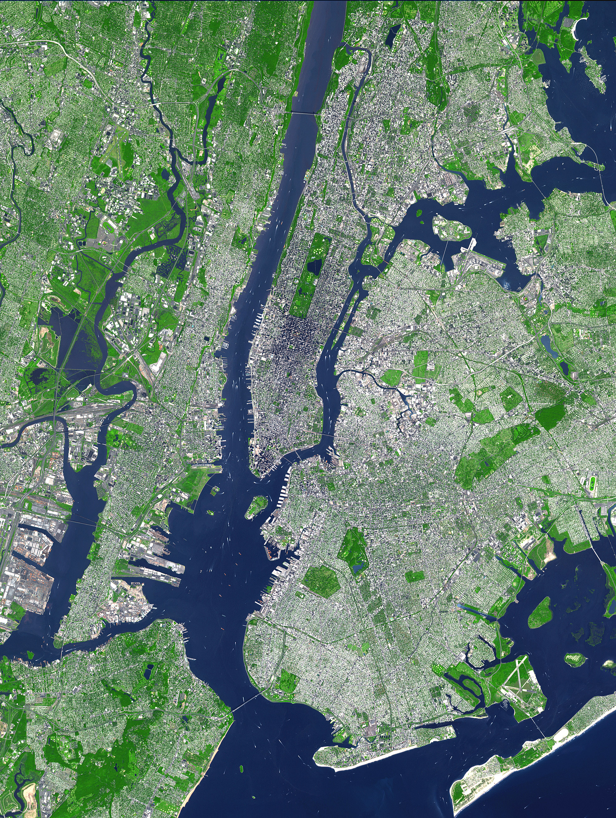
Fotografie + This false-color satellite image shows Greater New York City.
The Island of Manhattan juts southward from top center, bordered by the Hudson River to the west and the East River to the east (north is straight up in this scene.) In the middle of Manhattan, Central Park appears as a long green rectangle running roughly north-south with a large lake in the middle. The large land mass east of Manhattan is the western end of Long Island, which is comprised of the boroughs of Queens and Brooklyn and two counties, Nassau and Suffolk (not shown) which are not part of New York City. Parts of Staten Island (bottom left corner) and Breezy Point-Rockaway Beach (lower right)are also visible.
Source: http://earthobservatory.nasa.gov/Newsroom/NewImages/Images/aster_newyorkcity_lrg.jpg
This false-color image was acquired on Sept. 8, 2002, by the Advanced Spaceborne Thermal Emission and Reflection Radiometer (ASTER) aboard NASA's Terra satellite. The scene spans an area that is 27 km wide by 37 km tall. Vegetated land surface is green, paved urban areas are a whitish blue, and water is dark blue.
+ pochází z Wikimedia Commons, kde má status - Public domain (because it was created by NASA).
Historie souboru
Kliknutím na datum a čas se zobrazí tehdejší verze souboru.
| Datum a čas | Náhled | Rozměry | Uživatel | Komentář | |
|---|---|---|---|---|---|
| současná | 21. 5. 2013, 17:29 | | 1 964×2 607 (3,31 MB) | Sysop (diskuse | příspěvky) | (FILE1122) |
- Editovat tento soubor v externím programu (Více informací najdete v nápovědě pro nastavení.)
Odkazy na soubor
Na soubor odkazuje tato stránka:


