V encyklopedii Allmultimedia.cz byl aktivován špičkový grafický skin Foreground.
Foreground plně podporuje – RWD, HTML 5.0, Super Galerii a YouTube 2.0 !
Foreground plně podporuje – RWD, HTML 5.0, Super Galerii a YouTube 2.0 !
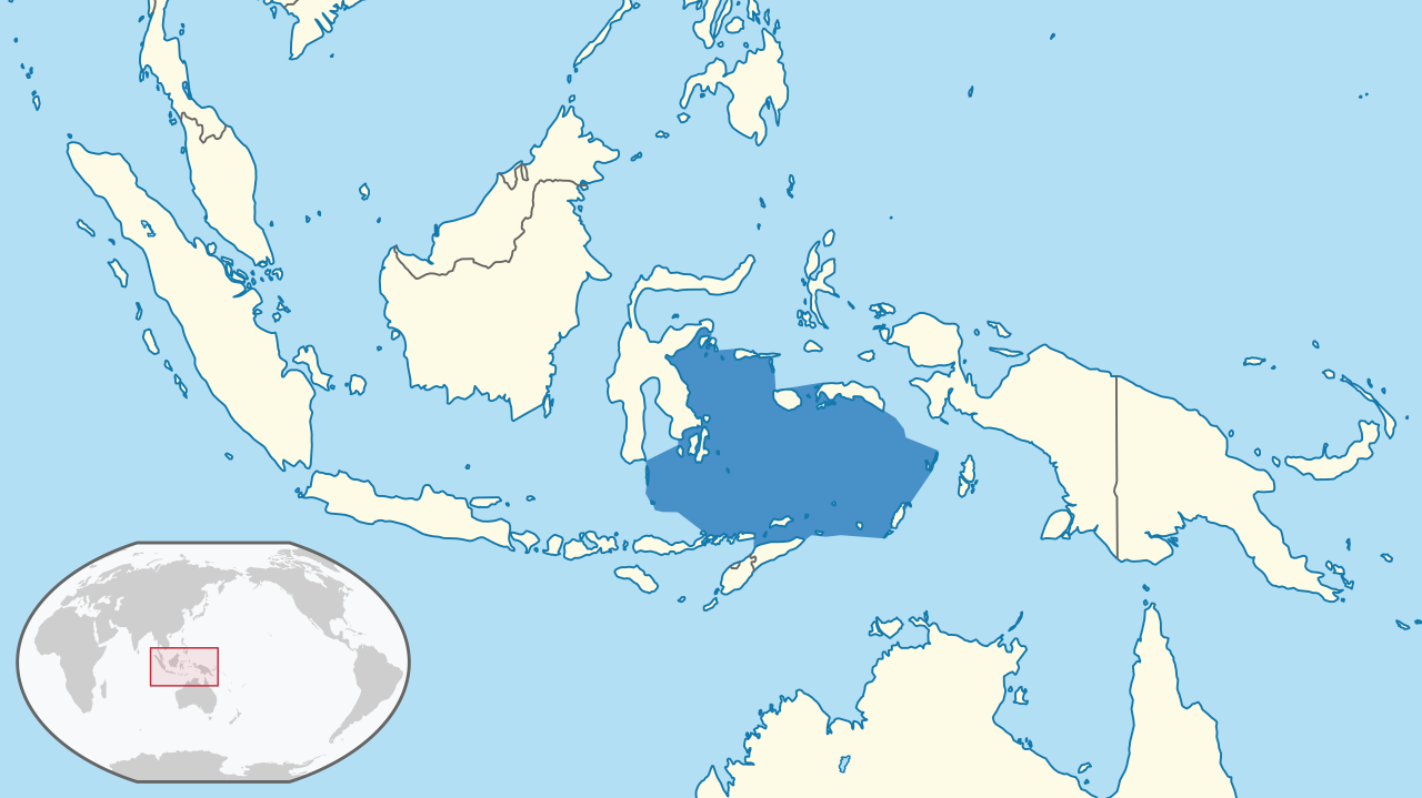
Soubor:Banda Sea in its region.png
Z Multimediaexpo.cz
Velikost tohoto náhledu je: 800 × 449 pixelů
Obrázek ve vyšším rozlišení (rozměr: 1 280 × 719 pixelů, velikost souboru: 196 kB, MIME typ: image/png)
Mapa + Description:
- English: Location of the Banda Sea in the region.
- The borders of the sea are approximately based on those from the IHO's "Limits of Oceans and Seas" Draft 3rd Edition, 1953.
- (Winkel III projection centred 150° East and standard parallels at 50°28'.)
- The map was created using data from Natural Earth and International Hydrographic Organization, IHO; Sieger, Rainer (2012): Limits of oceans and seas in digitized, machine readable form. Alfred Wegener Institute, Helmholtz Centre for Polar and Marine Research, Bremerhaven, PANGAEA, with mapshaper. (The former data source is in the public domain, the latter under CC BY.) For reproducibility purposes, this was the set of scripts used.
- The style of the map was generally intended to follow that of the German Locator maps project, except for the highlight colour of the sea, for which there was no apparent convention and for which dark blue (#4790c8) was used.
- Date: 1 August 2021
- Author: Aplaice
+ pochází z Wikimedia Commons, kde má status – This file is licensed under the Creative Commons Attribution-Share Alike 4.0 International license. (CC BY-SA 4.0)
Historie souboru
Kliknutím na datum a čas se zobrazí tehdejší verze souboru.
| Datum a čas | Náhled | Rozměry | Uživatel | Komentář | |
|---|---|---|---|---|---|
| současná | 17. 3. 2022, 10:28 | | 1 280×719 (196 kB) | Sysop (diskuse | příspěvky) | (Fotografie + ) |
- Editovat tento soubor v externím programu (Více informací najdete v nápovědě pro nastavení.)
Odkazy na soubor
Na soubor odkazuje tato stránka:


