V encyklopedii Allmultimedia.cz byl aktivován špičkový grafický skin Foreground.
Foreground plně podporuje – RWD, HTML 5.0, Super Galerii a YouTube 2.0 !
Foreground plně podporuje – RWD, HTML 5.0, Super Galerii a YouTube 2.0 !
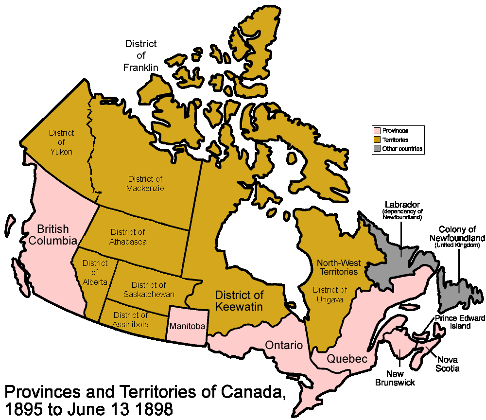
Soubor:Canada-1895.png
Z Multimediaexpo.cz
Velikost tohoto náhledu je: 694 × 600 pixelů
Obrázek ve vyšším rozlišení (rozměr: 1 000 × 864 pixelů, velikost souboru: 73 kB, MIME typ: image/png)
Mapa + Description: Territorial evolution of Canada Districts of the Northwest Territories 1895 saw the formation of the District of Franklin, District of Keewatin, District of Ungava and the District of Mackenzie. By this date the Provisional District of Athabasca had extended further west, now spanning the distance between British Columbia and the District of Keewatin.
- Date: 12 October 2007
- Source: Atlas of Saskatchewan The Atlas of Canada - Territorial Evolution, 1895 and Canada provinces 1881-1886
- Author: SriMesh
+ pochází z Wikimedia Commons, kde má status – Creative Commons Attribution-Share Alike 3.0 Unported, 2.5 Generic, 2.0 Generic and 1.0 Generic license.
Historie souboru
Kliknutím na datum a čas se zobrazí tehdejší verze souboru.
| Datum a čas | Náhled | Rozměry | Uživatel | Komentář | |
|---|---|---|---|---|---|
| současná | 9. 1. 2016, 11:03 | | 1 000×864 (73 kB) | Ivan Drago (diskuse | příspěvky) | (Fotografie + + pochází z Wikimedia Commons, kde má status – Kategorie:CC fotografie ) |
- Editovat tento soubor v externím programu (Více informací najdete v nápovědě pro nastavení.)
Odkazy na soubor
Na soubor odkazuje tato stránka:


