V pátek 26. dubna 2024 úderem 22 hodiny začíná naše nová
a opravdu velká série soutěží o nejlepší webovou stránku !!
Proto neváhejte a začněte hned zítra soutěžit o lákavé ceny !!
a opravdu velká série soutěží o nejlepší webovou stránku !!
Proto neváhejte a začněte hned zítra soutěžit o lákavé ceny !!
Soubor:IrishSeaReliefMap.jpg
Z Multimediaexpo.cz
Velikost tohoto náhledu je: 415 × 600 pixelů
Obrázek ve vyšším rozlišení (rozměr: 1 043 × 1 507 pixelů, velikost souboru: 2,15 MB, MIME typ: image/jpeg)
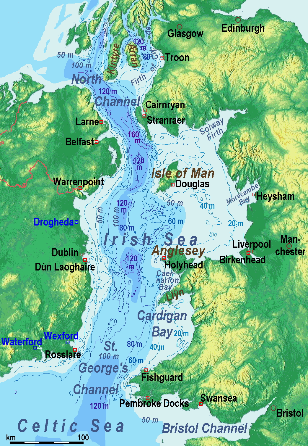
Mapa + Description:
- A map of the Irish Sea. Major ports shown with red marks. freight-only ports in blue.
- The old map with this lemma had significant mistakes of the bathymetry.
- Therefore on 2014-05-11, it was exchanged for a completely new map. Now the bathymetric content is an own work based on various informations.
- The countures of depth are drawn according to the UK source, the areal colours are derived from the Irish one. The land is from Maps for Free.
- Date: old map 2005-08-03; new map 2014-05-11
- Source: old map: http://www.vindaloo.uklinux.net/jjg/code/tmutils.html -> new map: Maps for Free and Own work
- Author: old one Users SFC9394, Seabhcan on en.wikipedia, new one Ulamm (11 May 2014)
+ pochází z Wikimedia Commons, kde má status – This file is licensed under the Creative Commons Attribution-Share Alike 3.0 Unported license. (CC BY-SA 3.0)
Historie souboru
Kliknutím na datum a čas se zobrazí tehdejší verze souboru.
| Datum a čas | Náhled | Rozměry | Uživatel | Komentář | |
|---|---|---|---|---|---|
| současná | 29. 3. 2022, 14:12 | | 1 043×1 507 (2,15 MB) | Sysop (diskuse | příspěvky) | (Fotografie + ) |
- Editovat tento soubor v externím programu (Více informací najdete v nápovědě pro nastavení.)
Odkazy na soubor
Na soubor odkazuje tato stránka:


