V pátek 26. dubna 2024 úderem 22 hodiny začíná naše nová
a opravdu velká série soutěží o nejlepší webovou stránku !!
Proto neváhejte a začněte hned zítra soutěžit o lákavé ceny !!
a opravdu velká série soutěží o nejlepší webovou stránku !!
Proto neváhejte a začněte hned zítra soutěžit o lákavé ceny !!
Soubor:Map of Zanzibar Archipelago-en.png
Z Multimediaexpo.cz
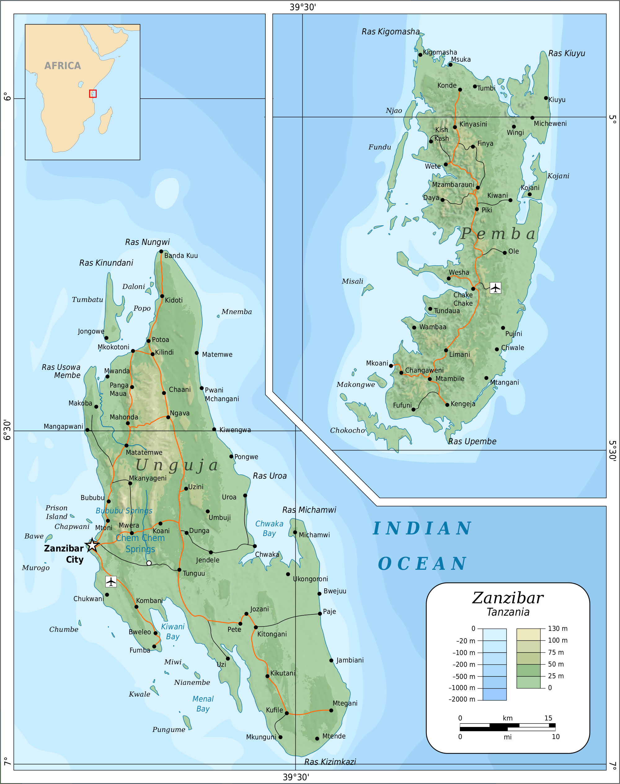
Velikost tohoto náhledu je: 474 × 599 pixelů
Obrázek ve vyšším rozlišení (rozměr: 2 000 × 2 529 pixelů, velikost souboru: 1,7 MB, MIME typ: image/png)
Mapa + Description:
- English: Topographic map of the Zanzibar Archipelago of the Western Indian Ocean, off the east coast of Africa in Tanzania.
- Suomi: Sansibarin saariston topografinen kartta.
- Roads, rivers and place names based on a public domain 1976 CIA map (from http://www.lib.utexas.edu/maps/tanzania.html) with some updates applied.
- Topography based on public domain SRTM data from NASA as modified by CGIAR.
- Bathymetry based on Becker et al., Global Bathymetry and Elevation Data at 30 Arc Seconds Resolution: SRTM30_PLUS, Marine Geodesy, 32:4, 355-371, 2009.
- The small outline of Africa was derived from File:BlankMap-Africa.svg.
- Data was processed in Perl.
- Everything was put together & laid out by Mysid in Inkscape and edited for validity in Vim.
- Date: 21 July 2010
- Author: Oona Räisänen
+ pochází z Wikimedia Commons, kde má status – This file is licensed under the Creative Commons Attribution-Share Alike 4.0 International, 3.0 Unported, 2.5 Generic, 2.0 Generic and 1.0 Generic license.
Historie souboru
Kliknutím na datum a čas se zobrazí tehdejší verze souboru.
| Datum a čas | Náhled | Rozměry | Uživatel | Komentář | |
|---|---|---|---|---|---|
| současná | 25. 11. 2020, 11:28 | | 2 000×2 529 (1,7 MB) | Sysop (diskuse | příspěvky) | (Mapa + Kategorie:Maps of Tanzania) |
- Editovat tento soubor v externím programu (Více informací najdete v nápovědě pro nastavení.)
Odkazy na soubor
Na soubor odkazují tyto 2 stránky:


