The English encyclopedia Allmultimedia.org will be launched in two phases.
The final launch of the Allmultimedia.org will take place on February 24, 2026
(shortly after the 2026 Winter Olympics).
Dovolená : 23. prosinec 2025 — 29. prosinec 2025
Holidays : December 23, 2025 — December 29, 2025
The final launch of the Allmultimedia.org will take place on February 24, 2026
(shortly after the 2026 Winter Olympics).
Dovolená : 23. prosinec 2025 — 29. prosinec 2025
Holidays : December 23, 2025 — December 29, 2025
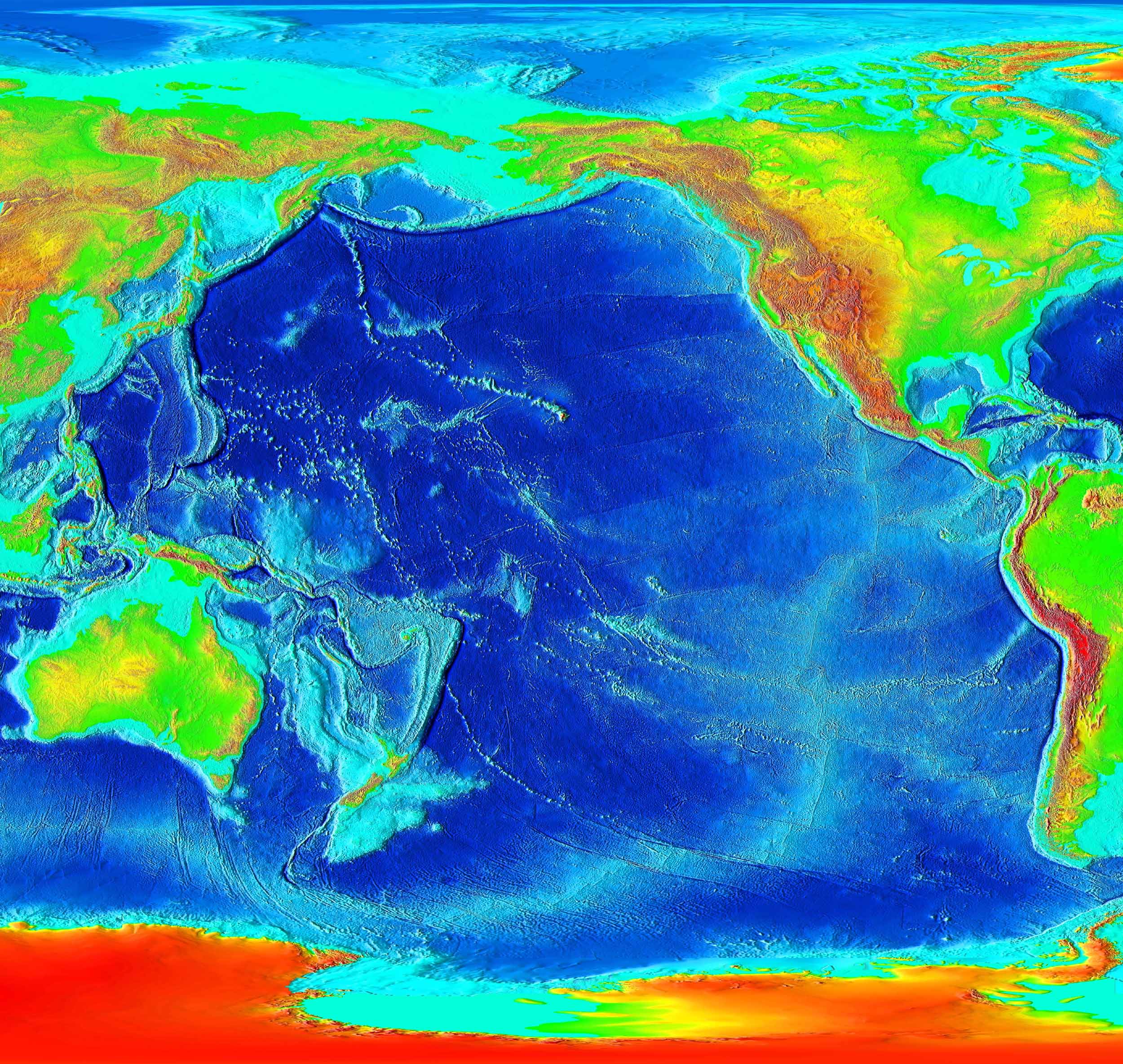
Soubor:Pacific elevation.jpg
Z Multimediaexpo.cz
Velikost tohoto náhledu je: 632 × 599 pixelů
Obrázek ve vyšším rozlišení (rozměr: 2 500 × 2 370 pixelů, velikost souboru: 899 kB, MIME typ: image/jpeg)
Mapa + English: Elevation of the Pacific ocean
- Source: ETOPO2v2, a digital database of seafloor and land elevations created by the World Data Center for Geophysics & Marine Geology (Boulder, CO), National Geophysical Data Center, NOAA.
+ pochází z Wikimedia Commons, kde má status – This image is in the public domain because it contains materials that originally came from the U.S. National Oceanic and Atmospheric Administration, taken or made as part of an employee's official duties.
Historie souboru
Kliknutím na datum a čas se zobrazí tehdejší verze souboru.
| Datum a čas | Náhled | Rozměry | Uživatel | Komentář | |
|---|---|---|---|---|---|
| současná | 5. 2. 2016, 10:44 | | 2 500×2 370 (899 kB) | Sysop (diskuse | příspěvky) | (Fotografie + + pochází z Wikimedia Commons, kde má status – ) |
- Editovat tento soubor v externím programu (Více informací najdete v nápovědě pro nastavení.)
Odkazy na soubor
Na soubor odkazuje tato stránka:


