V encyklopedii Allmultimedia.cz byl aktivován špičkový grafický skin Foreground.
Foreground plně podporuje – RWD, HTML 5.0, Super Galerii a YouTube 2.0 !
Foreground plně podporuje – RWD, HTML 5.0, Super Galerii a YouTube 2.0 !
Soubor:Plán Lhasy.jpg
Z Multimediaexpo.cz

Velikost tohoto náhledu je: 800 × 587 pixelů
Obrázek ve vyšším rozlišení (rozměr: 1 039 × 763 pixelů, velikost souboru: 222 kB, MIME typ: image/jpeg)
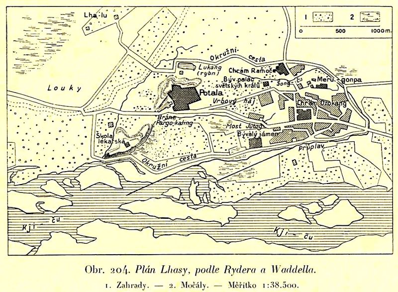
Mapa + Description: Map of Lhasa in the beginning of 20th century. The descriptions are in Czech.
- Date: 1932
- Source: Book Zeměpis světa, díl osmý, Přední Asie a Vysoká Asie. Published by publishing house Aventinum in Prague.
- Author: Unknown
+ pochází z Wikimedia Commons, kde má status – This work is in the public domain in its country of origin and other countries and areas where the copyright term is the author's life plus 70 years or less.
Historie souboru
Kliknutím na datum a čas se zobrazí tehdejší verze souboru.
| Datum a čas | Náhled | Rozměry | Uživatel | Komentář | |
|---|---|---|---|---|---|
| současná | 12. 2. 2019, 10:31 |  | 1 039×763 (222 kB) | Sysop (diskuse | příspěvky) | (Mapa + Description: Map of Lhasa in the beginning of 20th century. The descriptions are in Czech. * Date: 1932 * Source: Book Zeměpis světa, díl osmý, Přední Asie a Vysoká Asie. Published by publishing house Aventinum in Prague. * Author: Unknown ) |
- Editovat tento soubor v externím programu (Více informací najdete v nápovědě pro nastavení.)
Odkazy na soubor
Na soubor odkazuje tato stránka:
