V encyklopedii Allmultimedia.cz byl aktivován špičkový grafický skin Foreground.
Foreground plně podporuje – RWD, HTML 5.0, Super Galerii a YouTube 2.0 !
Foreground plně podporuje – RWD, HTML 5.0, Super Galerii a YouTube 2.0 !
Soubor:SaltGlaciers ZagrosMtns 20010810.jpg
Z Multimediaexpo.cz
Velikost tohoto náhledu je: 800 × 509 pixelů
Obrázek ve vyšším rozlišení (rozměr: 1 149 × 731 pixelů, velikost souboru: 231 kB, MIME typ: image/jpeg)
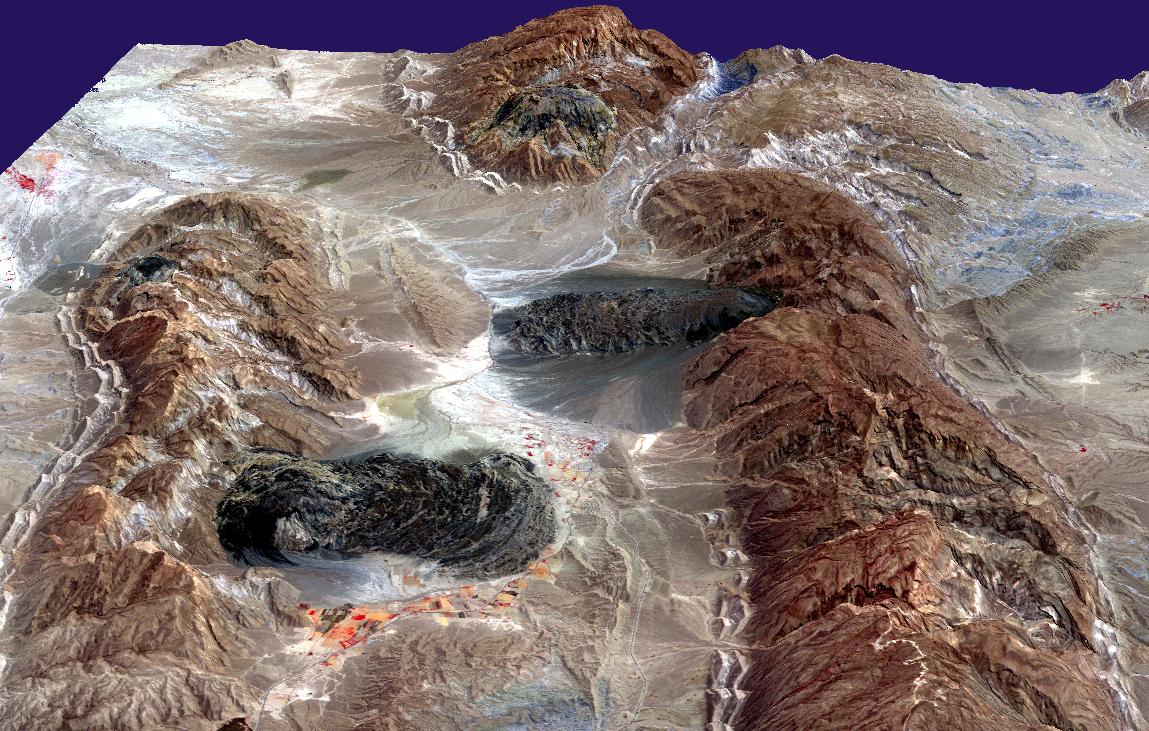
Fotografie + Description: Satellite imagery of salt domes and salt glaciers in the Zagros Mountains of southern Iran. This Aster perspective view was created by draping a band 3-2-1 (RGB) image over an ASTER-derived Digital Elevation Model (2x vertical exaggeration).
- Date: 10 August 2001
- Source: http://earthobservatory.nasa.gov/Newsroom/NewImages/images.php3?img_id=16435
- Author: NASA/GSFC/MITI/ERSDAC/JAROS, and U.S./Japan ASTER Science Team
+ pochází z Wikimedia Commons, kde má status – This file is in the public domain because it was solely created by NASA. NASA copyright policy states that "NASA material is not protected by copyright unless noted".
Historie souboru
Kliknutím na datum a čas se zobrazí tehdejší verze souboru.
| Datum a čas | Náhled | Rozměry | Uživatel | Komentář | |
|---|---|---|---|---|---|
| současná | 1. 4. 2013, 14:25 | | 1 149×731 (231 kB) | Sysop (diskuse | příspěvky) | (BUNDESA107) |
- Editovat tento soubor v externím programu (Více informací najdete v nápovědě pro nastavení.)
Odkazy na soubor
Na soubor odkazuje tato stránka:


