V pátek 26. dubna 2024 úderem 22 hodiny začíná naše nová
a opravdu velká série soutěží o nejlepší webovou stránku !!
Proto neváhejte a začněte hned zítra soutěžit o lákavé ceny !!
a opravdu velká série soutěží o nejlepší webovou stránku !!
Proto neváhejte a začněte hned zítra soutěžit o lákavé ceny !!
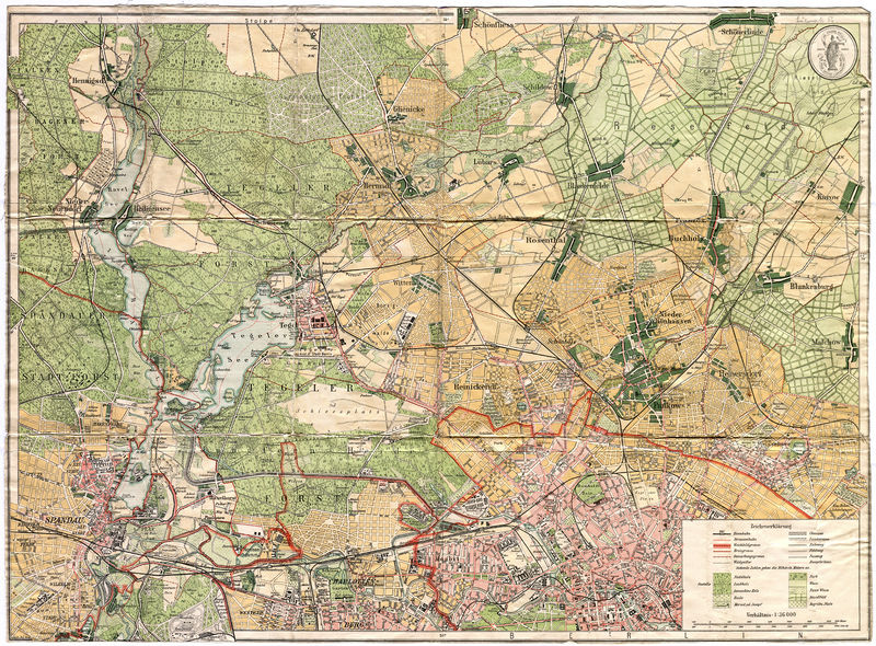
Soubor:Straube's Spezialkarte der nördlichen Vororte von Berlin 1909.jpg
Z Multimediaexpo.cz

Velikost tohoto náhledu je: 800 × 590 pixelů
Obrázek ve vyšším rozlišení (rozměr: 7 323 × 5 398 pixelů, velikost souboru: 20,81 MB, MIME typ: image/jpeg)
GIGANTICKÁ Mapa + Description: Straube's Spezialkarte der nördlichen Vororte von Berlin
- Format: 60,8 x 46,9 cm / 59,1 x 43,0 (n.d. Plan)
- Orientierung: Nord
- Maßstab: 1: 36 000
- Farblithografie
- Im Vergleich zu den Vorgängerplänen fehlt hier der Titel und die Herkunftsangaben unterhalb des Plans. Rechts oben ist jetzt die Schutzmarke von Straube eingefügt. Im Rahmen Längen- und Breitengrad (nach Ferro). Der Plan reicht östlich von Spandau bis westlich nach Weißensee, sowie südlich von Charlottenburg bis nördlich nach Schönfließ.
- Date: 1909
- Source: Self-scanned
- Author: de:Julius Straube
+ pochází z Wikimedia Commons, kde má status – This work is in the public domain in the European Union and non-EU countries with a copyright term of life of the author plus 70 years or less.
Historie souboru
Kliknutím na datum a čas se zobrazí tehdejší verze souboru.
| Datum a čas | Náhled | Rozměry | Uživatel | Komentář | |
|---|---|---|---|---|---|
| současná | 23. 2. 2015, 23:55 |  | 7 323×5 398 (20,81 MB) | Sysop (diskuse | příspěvky) | (GIGANTICKÁ_Fotografie_+_32) |
- Editovat tento soubor v externím programu (Více informací najdete v nápovědě pro nastavení.)
Odkazy na soubor
Na tento soubor neodkazuje žádná stránka.
