The English encyclopedia Allmultimedia.org will be launched in two phases.
The final launch of the Allmultimedia.org will take place on February 24, 2026
(shortly after the 2026 Winter Olympics).
Dovolená : 23. prosinec 2025 — 29. prosinec 2025
Holidays : December 23, 2025 — December 29, 2025
The final launch of the Allmultimedia.org will take place on February 24, 2026
(shortly after the 2026 Winter Olympics).
Dovolená : 23. prosinec 2025 — 29. prosinec 2025
Holidays : December 23, 2025 — December 29, 2025
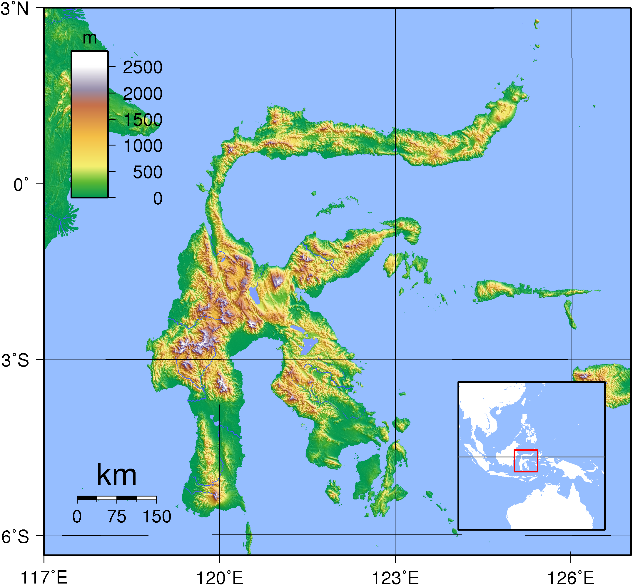
Soubor:Sulawesi Topography.png
Z Multimediaexpo.cz
Velikost tohoto náhledu je: 649 × 600 pixelů
Obrázek ve vyšším rozlišení (rozměr: 2 153 × 1 990 pixelů, velikost souboru: 1,71 MB, MIME typ: image/png)
Mapa + English: Relief (hypsometric) map of Sulawesi. Created with GMT from publicly released SRTM data.
- Français : Carte du relief de l'île indonésienne de Sulawesi. Image produite à l'aide de la suite logicielle GMT à partir des données publiques SRTM. Une version locator est disponible.
- Date: 1 September 2007
- Author: Sadalmelik
+ pochází z Wikimedia Commons, kde má status – Creative Commons Attribution-Share Alike 3.0 Unported, 2.5 Generic, 2.0 Generic and 1.0 Generic license.
Historie souboru
Kliknutím na datum a čas se zobrazí tehdejší verze souboru.
| Datum a čas | Náhled | Rozměry | Uživatel | Komentář | |
|---|---|---|---|---|---|
| současná | 30. 9. 2016, 22:18 | | 2 153×1 990 (1,71 MB) | Sysop (diskuse | příspěvky) | (Fotografie + + pochází z Wikimedia Commons, kde má status – Kategorie:CC fotografie ) |
- Editovat tento soubor v externím programu (Více informací najdete v nápovědě pro nastavení.)


