The English encyclopedia Allmultimedia.org will be launched in two phases.
The final launch of the Allmultimedia.org will take place on February 24, 2026
(shortly after the 2026 Winter Olympics).
Dovolená : 23. prosinec 2025 — 29. prosinec 2025
Holidays : December 23, 2025 — December 29, 2025
The final launch of the Allmultimedia.org will take place on February 24, 2026
(shortly after the 2026 Winter Olympics).
Dovolená : 23. prosinec 2025 — 29. prosinec 2025
Holidays : December 23, 2025 — December 29, 2025
Soubor:Un-chad.png
Z Multimediaexpo.cz
Velikost tohoto náhledu je: 478 × 600 pixelů
Obrázek ve vyšším rozlišení (rozměr: 2 348 × 2 947 pixelů, velikost souboru: 1,38 MB, MIME typ: image/png)
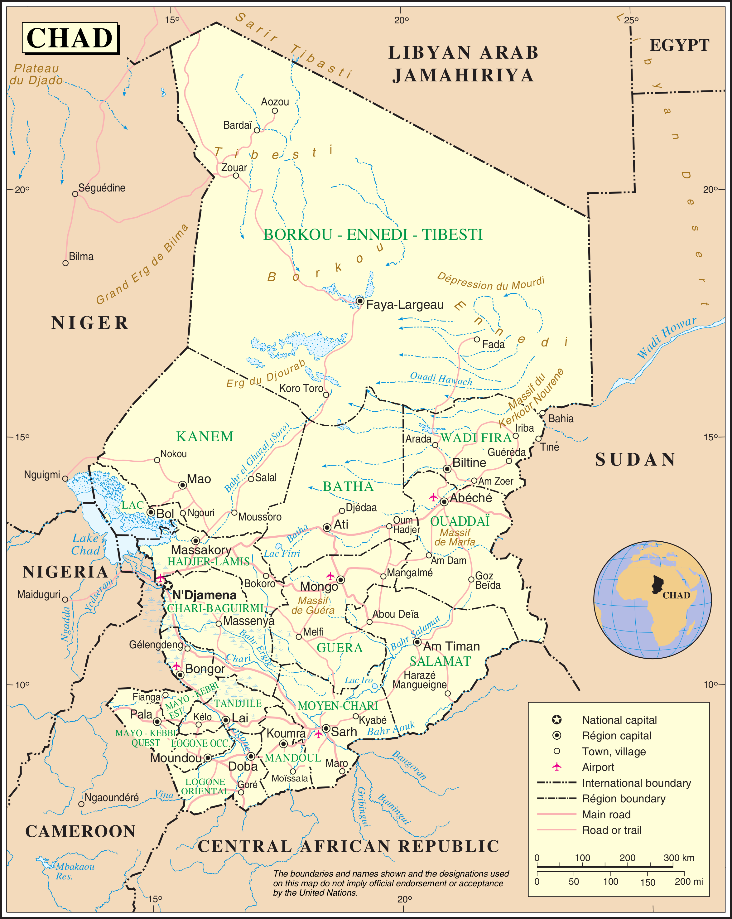
Mapa + Description:
- English: Map of Chad, showing region names and borders as of 2007. Based on UN map number 3788 (modified to remove UN name and reference number).
- Date: 2007
- Source:
- Page: http://www.un.org/Depts/Cartographic/english/htmain.htm
- Map: http://www.un.org/Depts/Cartographic/map/profile/chad.pdf (archived 10 October 2007)
- Author: United Nations, Cartographic Section
+ pochází z Wikimedia Commons, kde má status – This image is a map derived from a United Nations map. Unless stated otherwise, UN maps are to be considered in the public domain. This applies worldwide.
Historie souboru
Kliknutím na datum a čas se zobrazí tehdejší verze souboru.
| Datum a čas | Náhled | Rozměry | Uživatel | Komentář | |
|---|---|---|---|---|---|
| současná | 15. 4. 2014, 12:01 | | 2 348×2 947 (1,38 MB) | Sysop (diskuse | příspěvky) | (MW1.15-Fotografie) |
- Editovat tento soubor v externím programu (Více informací najdete v nápovědě pro nastavení.)
Odkazy na soubor
Na soubor odkazuje tato stránka:


