The final launch of the Allmultimedia.org will take place on February 24, 2026
(shortly after the 2026 Winter Olympics).
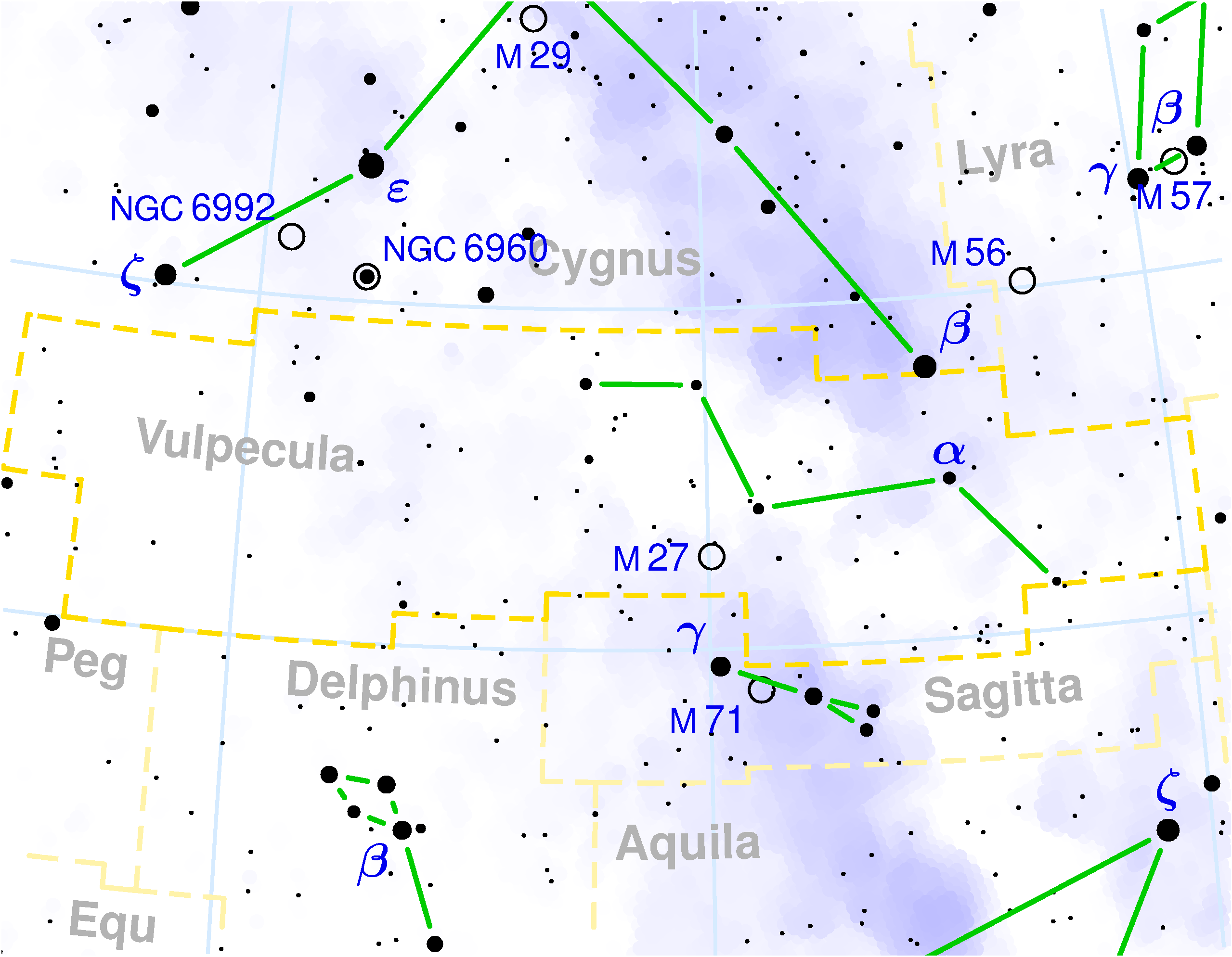
Soubor:Vulpecula constellation map.png
Z Multimediaexpo.cz
Velikost tohoto náhledu je: 771 × 599 pixelů
Obrázek ve vyšším rozlišení (rozměr: 2 559 × 1 989 pixelů, velikost souboru: 368 kB, MIME typ: image/png)
Astronomická mapa + English: Volpecula constellation map
It was created by Torsten Bronger using the program PP3 on 2003/08/18.
The yellow dashed lines are constellation boundaries, the red dashed line is the ecliptic, and the shades of blue show Milky Way areas of different brightness. The map contains all Messier objects, except for colliding ones. The underlying database contains all stars brighter than 6.5. All coordinates refer to equinox 2000.0.
The map is calculated with the equidistant azimuthal projection (the zenith being in the center of the image). The north pole is to the top. The (horizontal) lines of equal declination are drawn for 0°, ±10°, ±20° etc. The lines of equal rectascension are drawn for all 24 hours. Towards the rim there is a very slight magnification (and distortion).
+ pochází z Wikimedia Commons, kde má status – GNU Free Documentation License, Version 1.2 or any later version (Copyright © 2003 Torsten Bronger).
Historie souboru
Kliknutím na datum a čas se zobrazí tehdejší verze souboru.
| Datum a čas | Náhled | Rozměry | Uživatel | Komentář | |
|---|---|---|---|---|---|
| současná | 6. 11. 2013, 10:18 | | 2 559×1 989 (368 kB) | Sysop (diskuse | příspěvky) | (Astronomická mapa + English: + pochází z Wikimedia Commons, kde má status – GNU Free Documentation License, Version 1.2 or any later version. Kategorie:GNU fotografie Kategorie:Constellations maps) |
- Editovat tento soubor v externím programu (Více informací najdete v nápovědě pro nastavení.)
Odkazy na soubor
Na soubor odkazuje tato stránka:


