Soubor:Tunguska explosion area map 4.png
Z Multimediaexpo.cz
Velikost tohoto náhledu je: 595 × 599 pixelů
Obrázek ve vyšším rozlišení (rozměr: 1 778 × 1 790 pixelů, velikost souboru: 299 kB, MIME typ: image/png)
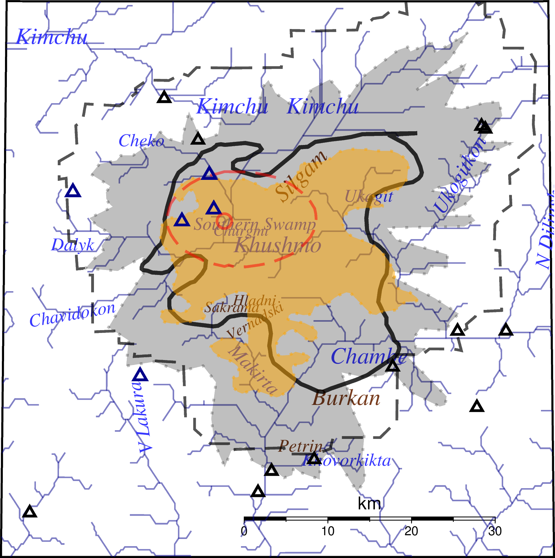
Mapa + Description:
- English: Red circle: Explosion site, ground zero.
- Red dashed ellipse: very strong burning effect. Yellow area: forest fire. Black line: almost all trees fallen on most areas. Grey area: Trees fallen in may areas. Black dashed line: Trees maybe fallen.
- Black triangles: mainly habitated tents, some maybe storage tents.
- Blue triangles: mainly unhabitated storage tents.
- Date: 3 October 2024
- Author: User:Merikanto
+ pochází z Wikimedia Commons, kde má status – This file is licensed under the Creative Commons Attribution 4.0 International license. (CC BY 4.0)
Historie souboru
Kliknutím na datum a čas se zobrazí tehdejší verze souboru.
| Datum a čas | Náhled | Rozměry | Uživatel | Komentář | |
|---|---|---|---|---|---|
| současná | 30. 6. 2026, 08:59 | | 1 778×1 790 (299 kB) | Sysop (diskuse | příspěvky) | (Fotografie + ) |
- Editovat tento soubor v externím programu (Více informací najdete v nápovědě pro nastavení.)
Odkazy na soubor
Na tento soubor neodkazuje žádná stránka.


