V pátek 26. dubna 2024 úderem 22 hodiny začíná naše nová
a opravdu velká série soutěží o nejlepší webovou stránku !!
Proto neváhejte a začněte hned zítra soutěžit o lákavé ceny !!
a opravdu velká série soutěží o nejlepší webovou stránku !!
Proto neváhejte a začněte hned zítra soutěžit o lákavé ceny !!
Výsledky hledání
Z Multimediaexpo.cz
Stránky s odpovídajícím názvem

Soubor:Staffordshire Yeomanry Operation Goodwood.png 800×799 (452 088 bajtů) - 27. 9. 2014, 12:04
Soubor:Across Smestow Valley near Greensforge, Staffordshire - geograph.org.uk - 681054.jpg 640×480 (129 579 bajtů) - 5. 6. 2017, 08:37
Soubor:Across the Fields to The Million, Staffordshire - geograph.org.uk - 680560.jpg 640×480 (131 570 bajtů) - 5. 6. 2017, 08:37
Soubor:Arable Land south of Seisdon, Staffordshire - geograph.org.uk - 696192.jpg 640×425 (138 140 bajtů) - 5. 6. 2017, 08:41
Soubor:Bridge No 61, Staffordshire and Worcestershire Canal, Wolverhampton - geograph.org.uk - 689550.jpg 640×427 (142 975 bajtů) - 6. 6. 2017, 22:10
Soubor:Bridge over Spittle Brook, Checkhill, Staffordshire - geograph.org.uk - 681020.jpg 640×452 (141 675 bajtů) - 6. 6. 2017, 22:10
Soubor:Bridge and Lane at Greensforge, Staffordshire - geograph.org.uk - 682049.jpg 640×450 (150 826 bajtů) - 6. 6. 2017, 22:10
Soubor:Bridge 63, Staffordshire and Worcestershire Canal, Wolverhampton - geograph.org.uk - 689449.jpg 502×640 (148 286 bajtů) - 6. 6. 2017, 22:10
Soubor:Bridleway towards Seisdon, Staffordshire - geograph.org.uk - 696188.jpg 640×479 (151 494 bajtů) - 6. 6. 2017, 22:27
Soubor:Bridleway to Trysull, Staffordshire - geograph.org.uk - 680118.jpg 479×640 (137 624 bajtů) - 6. 6. 2017, 22:27
Soubor:Bridleway on Abbot's Castle Hill, Staffordshire - geograph.org.uk - 696519.jpg 640×480 (144 394 bajtů) - 6. 6. 2017, 22:27
Soubor:Car Auction in Progress, Smestow Bridge, Staffordshire - geograph.org.uk - 680132.jpg 640×475 (141 099 bajtů) - 6. 6. 2017, 22:36
Soubor:Cottage, and Bridleway towards Seisdon, Staffordshire - geograph.org.uk - 696183.jpg 640×442 (149 607 bajtů) - 8. 6. 2017, 08:07
Soubor:Cottages near Enville, Staffordshire - geograph.org.uk - 680586.jpg 640×466 (146 223 bajtů) - 8. 6. 2017, 08:07
Soubor:Crossroads south of Highgate, Staffordshire - geograph.org.uk - 680494.jpg 640×458 (132 123 bajtů) - 8. 6. 2017, 08:10
Soubor:Crop Fields south of Seisdon, Staffordshire - geograph.org.uk - 696198.jpg 640×406 (144 908 bajtů) - 8. 6. 2017, 08:10
Soubor:Crop Fields west of Seisdon, Staffordshire - geograph.org.uk - 692136.jpg 640×430 (146 154 bajtů) - 8. 6. 2017, 08:10
Soubor:Crop Fields towards Trysull, Staffordshire - geograph.org.uk - 696453.jpg 640×421 (133 717 bajtů) - 8. 6. 2017, 08:10
Soubor:Crop Fields towards Seisdon, Staffordshire - geograph.org.uk - 696392.jpg 640×480 (145 805 bajtů) - 8. 6. 2017, 08:10
Soubor:Crop Fields south of Seisdon, Staffordshire - geograph.org.uk - 696420.jpg 640×475 (158 697 bajtů) - 8. 6. 2017, 08:10


Stránky s odpovídajícím textem

Soubor:Something Nasty by the Canal, Stoke-on-Trent, Staffordshire - geograph.org.uk - 555828.jpg * English: Something Nasty by the Canal, Stoke-on-Trent, Staffordshire. Just above Lock 37, and already encroaching into the southern end of the c640×480 (138 661 bajtů) - 29. 4. 2021, 08:05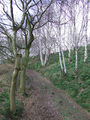
Soubor:Bridleway leading to the Staffordshire Way, near Seisdon, Staffordshire - geograph.org.uk - 365950.jpg ...y lined oak to the left, birch to the right! The visible ridge line is the Staffordshire Way Path.480×640 (175 509 bajtů) - 30. 1. 2022, 13:02


Ukázat (20 předchozích | 20 následujících) (20 | 50 | 100 | 250 | 500).