The final launch of the Allmultimedia.org will take place on February 24, 2026
(shortly after the 2026 Winter Olympics).
Dovolená : 23. prosinec 2025 — 29. prosinec 2025
Holidays : December 23, 2025 — December 29, 2025
Soubor:Pollution over east China.jpg
Z Multimediaexpo.cz
Velikost tohoto náhledu je: 782 × 600 pixelů
Obrázek ve vyšším rozlišení (rozměr: 6 000 × 4 600 pixelů, velikost souboru: 2,12 MB, MIME typ: image/jpeg)
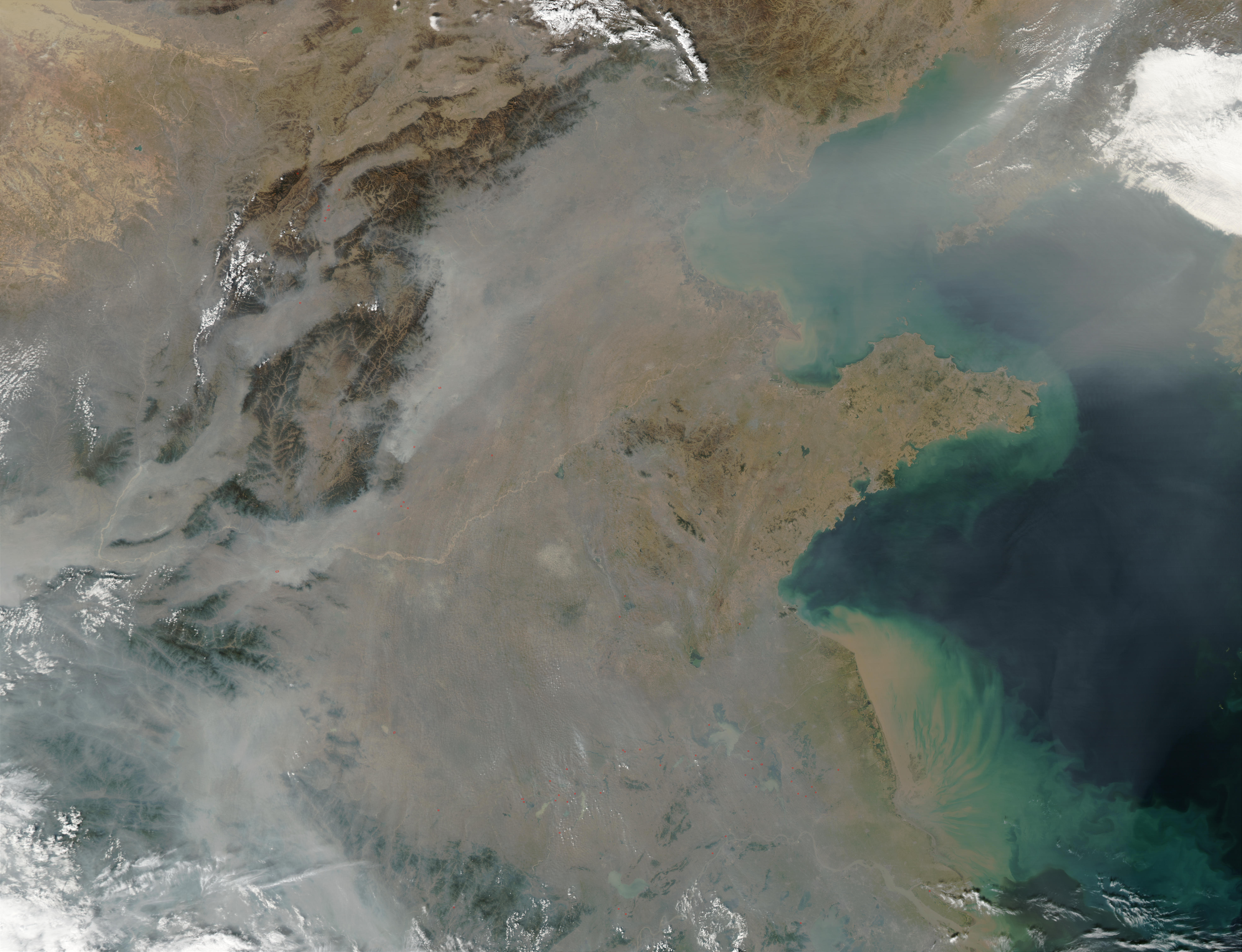
Fotografie + This true-color image over eastern China was acquired by the Moderate Resolution Imaging Spectroradiometer (MODIS), flying aboard NASA’s Aqua satellite, on Oct. 16, 2002 [1]. The scene reveals dozens of fires burning on the surface (red dots) and a thick pall of smoke and haze (greyish pixels) filling the skies overhead. Notice in the high-resolution version of this image how the smog fills the valleys and courses around the contours of the terrain in China’s hilly and mountainous regions. The terrain higher in elevation is less obscured by the smog than the lower lying plains and valleys in the surrounding countryside.
This scene spans roughly from Beijing (near top center) to the Yangtze River, the mouth of which can be seen toward the bottom right. Toward the upper right corner, the Bo Hai Bay is rather obscured by the plume of pollution blowing eastward toward Korea and the Pacific Ocean. Toward the bottom right, the Yangtze River is depositing its brownish, sediment-laden waters into the Yellow Sea. 2007-03-16
+ pochází z Wikimedia Commons, kde má status - Toto dílo je ve Spojených státech volným dílem, protože jde o dílo úřadů americké federální vlády podle ustanovení Hlavy 17, Kapitoly 1, Sekce 105 amerického právního řádu.
Historie souboru
Kliknutím na datum a čas se zobrazí tehdejší verze souboru.
| Datum a čas | Náhled | Rozměry | Uživatel | Komentář | |
|---|---|---|---|---|---|
| současná | 27. 5. 2013, 18:02 | | 6 000×4 600 (2,12 MB) | Sysop (diskuse | příspěvky) | (FILES2G999) |
- Editovat tento soubor v externím programu (Více informací najdete v nápovědě pro nastavení.)
Odkazy na soubor
Na soubor odkazuje tato stránka:


