Soubor:Spain.png
Z Multimediaexpo.cz
Velikost tohoto náhledu je: 696 × 599 pixelů
Obrázek ve vyšším rozlišení (rozměr: 992 × 854 pixelů, velikost souboru: 380 kB, MIME typ: image/png)
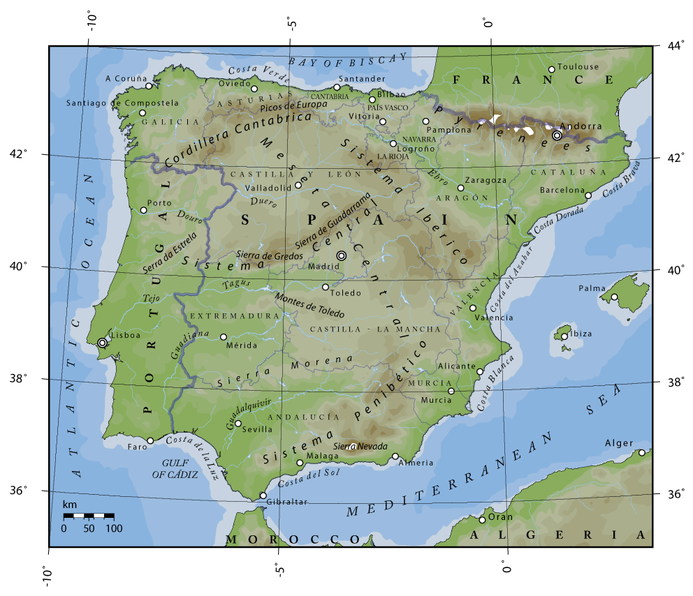
Mapa + Description:
- Topographical map of Spain. Author: Bas de Jong Sources:
- U.S. National Geophysical Data Center (NGDC)
- The Times Atlas of the World. 11th ed. London: Times Books, 2005.
- "Spain." Encyclopædia Britannica from Encyclopædia Britannica Online. <http://www.search.eb.com/eb/article-70258> [Accessed February, 2006].
- Contributors of Wikipedia, "Sistema Central," Wikipedia, La enciclopedia libre, http://es.wikipedia.org/w/index.php?title=Sistema_Central&oldid=2294461 (accessed February 2006).
- PS: Valencia's location is wrong as it is situated just by the sea Other versions:
- File:Spain heb.png
- Date: 14 February 2006 (original upload date)
- Author: Ζεύς
+ pochází z Wikimedia Commons, kde má status – This file is licensed under the Creative Commons Attribution-Share Alike 2.5 Generic, 2.0 Generic and 1.0 Generic license.
Historie souboru
Kliknutím na datum a čas se zobrazí tehdejší verze souboru.
| Datum a čas | Náhled | Rozměry | Uživatel | Komentář | |
|---|---|---|---|---|---|
| současná | 29. 6. 2026, 11:41 | | 992×854 (380 kB) | Sysop (diskuse | příspěvky) | (Fotografie + ) |
- Editovat tento soubor v externím programu (Více informací najdete v nápovědě pro nastavení.)
Odkazy na soubor
Na soubor odkazuje tato stránka:


